


First Published By: National Hurricane Center
Date: Monday 4th September, 2017

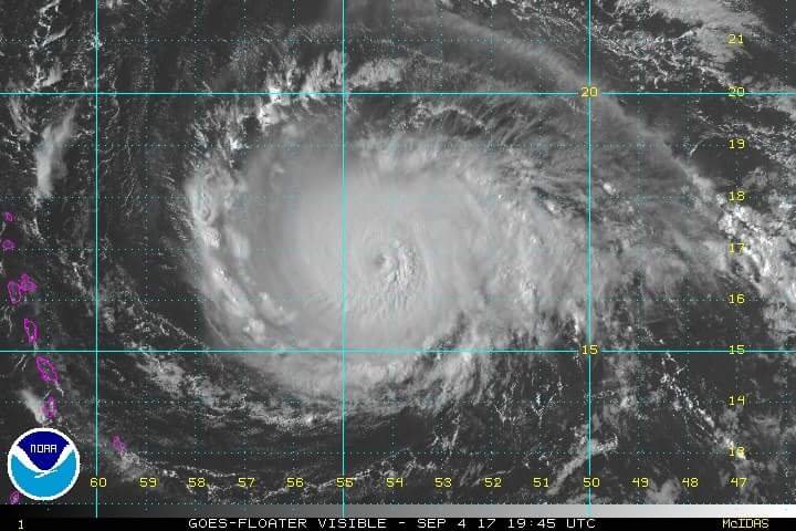
SKN PULSE – According to information from the national Hurricane center, Irma is strengthening as it heads toward the Leeward Islands.
Preparations within the warning area should be rushed to completion. Irma is centered as of 5 p.m. AST/EDT about 490 miles (790 km) east of the Leeward Islands. Irma is moving toward the west near 13 mph (20 km/h) and this general motion is expected to continue into Tuesday, followed by a turn toward the west-northwestward late Tuesday.
The forecast track model indicates that the center of Irma will move near or over portions of the northern Leeward Islands Tuesday night and early Wednesday.
A Hurricane Warning is in effect for Antigua, Barbuda, Anguilla, Montserrat, St. Kitts, Nevis, Saba, St. Eustatius, Sint Maarten, Saint Martin and Saint Barthelemy. A Hurricane Watch is in effect for Guadeloupe, British Virgin Islands, U.S. Virgin Islands, Puerto Rico, Vieques, and Culebra. A Tropical Storm Warning is in effect for Guadeloupe. A Tropical Storm Watch is in effect for Dominica.

Hurricane conditions are expected within the hurricane warning area by Tuesday night, with tropical storm conditions expected by late Tuesday. Hurricane conditions are possible within the hurricane watch area in the Virgin Islands and Puerto Rico by late Wednesday, with tropical storm conditions possible by early Wednesday. Tropical Storm conditions are expected within the tropical storm warning area by late Tuesday.
Published Data from an Air Force Reserve Hurricane Hunter aircraft indicate that the maximum sustained winds have increased to near 130 mph (215 km/h) with higher gusts -a Category 4 hurricane on the Saffir-Simpson Hurricane Wind Scale. Additional strengthening during the next 48 hours is forecast.
Hurricane-force winds extend outward up to 40 miles (65 km) from the center and tropical-storm-force winds extend outward up to 140 miles (220 km).
Users are reminded to not focus on the exact forecast track since strong winds and heavy rainfall extend well away from the center. In addition, average NHC track errors are about 175 and 225 statute miles at days 4 and 5, respectively.
The National Hurricane Center will issue its next complete advisory at 11 p.m. AST/EDT with an intermediate advisory at 8 p.m. AST/EDT – www.hurricanes.gov
-National Hurricane Center